Modelling Drought Risks for Government Water Planners
Saint Kitts and Nevis is using drought modelling and water resource mapping to anticipate shortages, improve groundwater management and provide communities with more reliable water supplies.
Solution factsheet
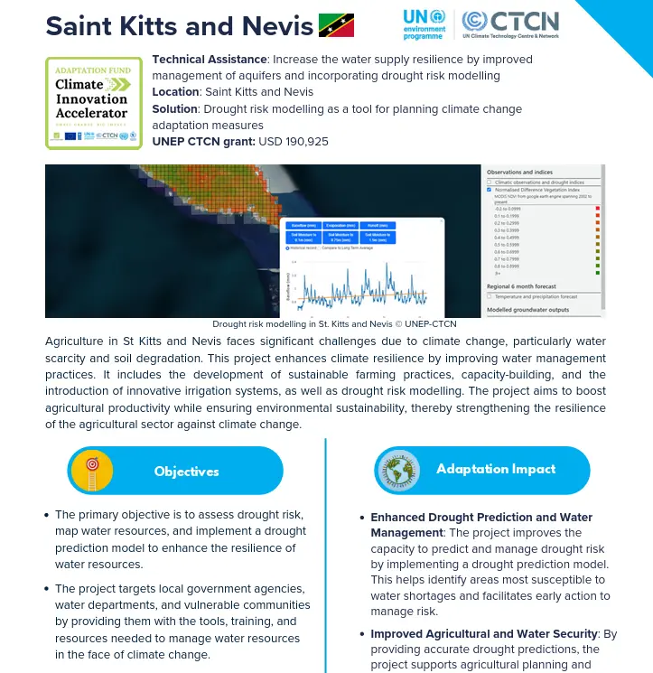 |
Download the solution factsheet to learn more about this climate innovation in Saint Kitts and Nevis. |
Overview
The project combines hydrological modelling, GIS and remote sensing to assess water resources, map drought risk and estimate future water availability. Groundwater assessments help planners understand the aquifers that support water supplies, while early warning communications share drought information with relevant authorities.
Training equips national officers to use the model and risk maps to identify vulnerable areas, plan water use and take earlier action to reduce the impact of shortages.
At a glance
| Organisation |
Department of Environment |
| Primary sector |
Early Warning Systems |
| Innovation stage | 💡 Transition to Scale |
| AFCIA Programme |  |
Funding Received
|
$
|
AFCIA funding
USD 201,553
|
|
$
|
Additional FINANCE
USD 100,000
CARPHA
|
Climate impacts addressed

Drought and water security
|
Project team
 |
Marcus Nield
Communication Expert
|
Go to profile Send message |